Recon
Takes a cycling route and reports what is on it: the water, the climbs, and the weather and light for the hour you will be there.
A route comes in from Ride with GPS, from a GPX file, from a shared link, or by scanning a QR code from another rider's phone. No account is required.
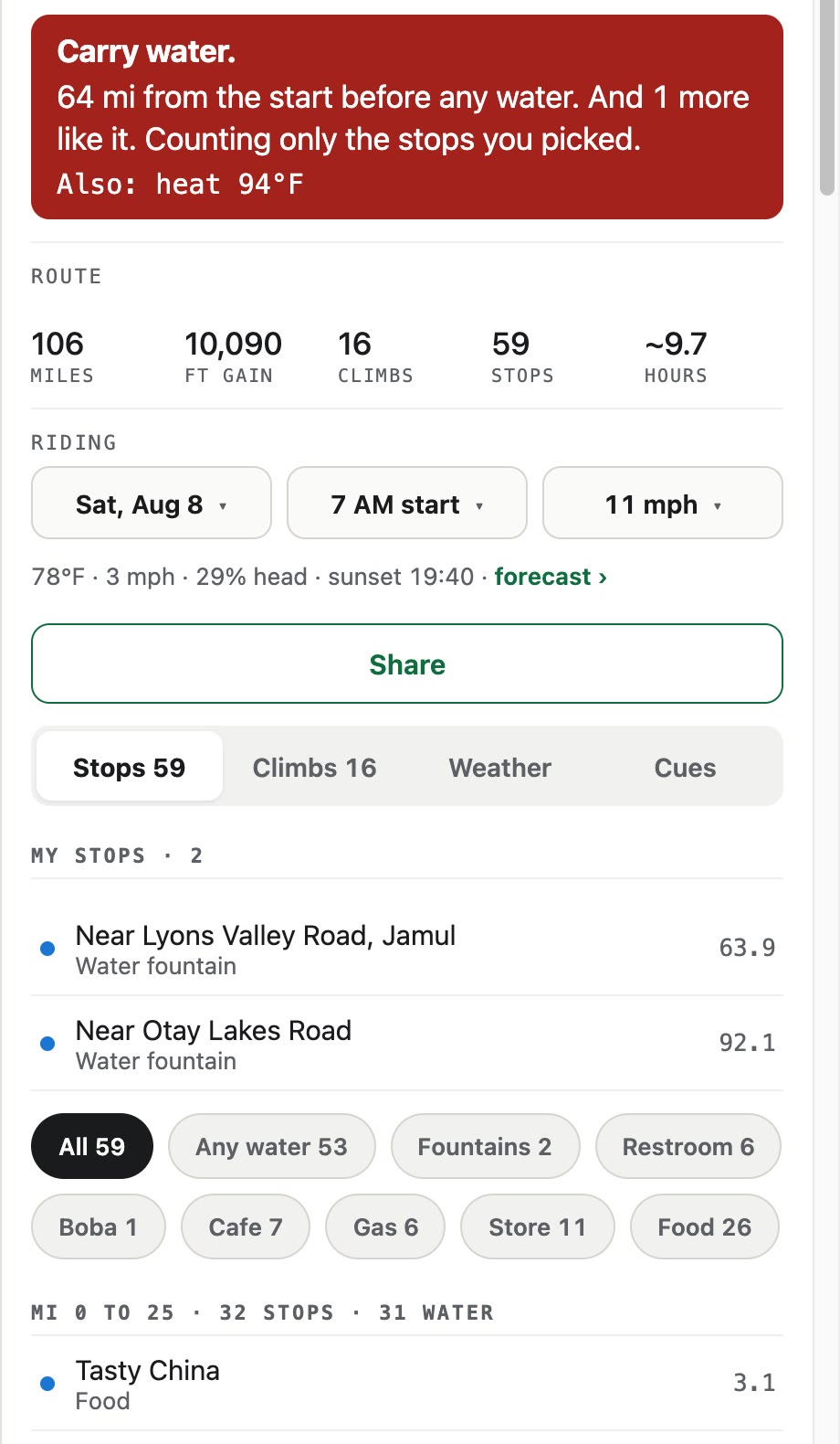
- Climbs found
- 16, each measured for length, gain, and steepest pitch
- Longest dry stretch
- 64 miles from the start before the first water, and one more gap like it, counting only the two fountains picked as planned stops
- Water on the route
- 53 of the 59 stops found have water; two are public fountains. The on-device archive covers California
- Heat
- 94°F at the hottest, reached around mile 85
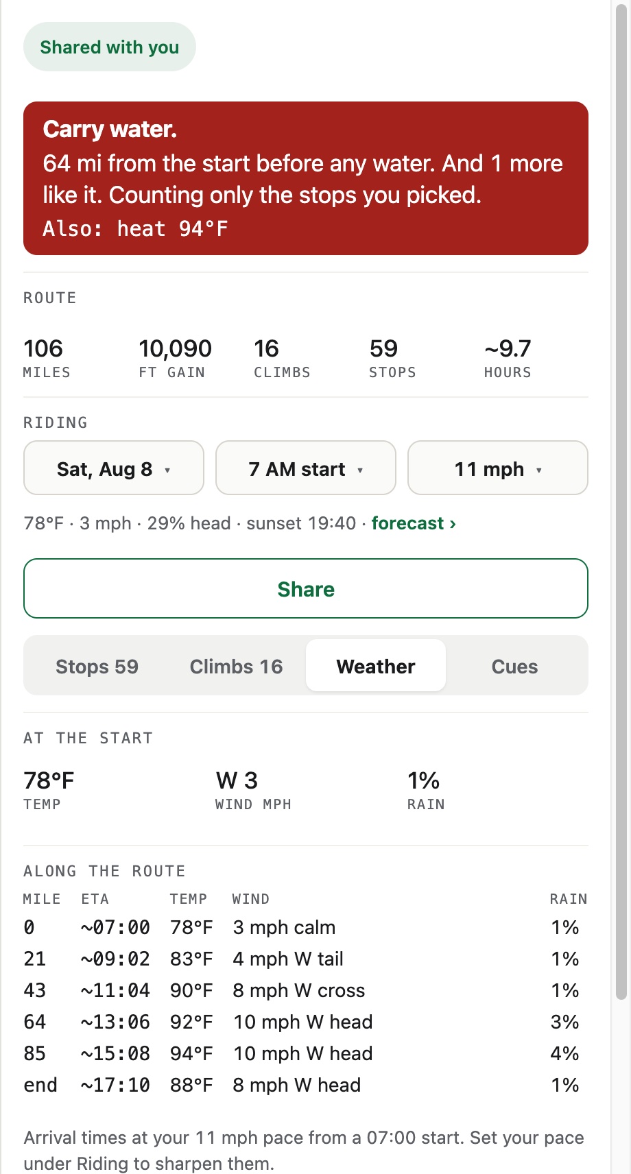
- Wind
- A 10 mph headwind at mile 85; every hour is read as head, cross, or tail against your direction of travel
- Light
- Sunset 19:40, against roughly 9.7 hours of riding at 11 mph
- Without a signal
- The route and the map both save; a saved route opens with no signal at all
The climbing
Climbs are found in the track itself and reported with their start, end, and gradient. Minor bumps are filtered out so the list stays short enough to read. The gain total is Ride with GPS's figure, and Recon says so on the tab. The climbs themselves are measured from USGS terrain data, checked against a barometric ride. Tap a climb and the map goes to it and draws it.

The day you are riding
Give a pace and Recon works out when you would be at each point of the route, then reports the weather hour by hour along it. Wind is resolved against the direction of travel into headwind, crosswind, and tailwind, so the same wind reads as a crosswind at mile 43 and a headwind at mile 64. Sunrise and sunset are computed on the device, so a route can be planned for any day of the year. Forecasts run 16 days ahead and get less certain the further out they go.
What might go wrong
Six conditions are watched: heat, cold, wind, rain, darkness, and air quality. The one most likely to affect that particular ride is stated in full. The rest sit beside it in a quieter line.
Taking it out on the road
The route exports as a course file carrying both the turn directions and the notes Recon writes about what is coming: the climb starting, the last water for a while. You can add your own, and when the list would crowd a head unit, Recon drops its own lowest priority cues first and says so. A Wahoo or Garmin head unit that supports course messages shows them as banners while you ride, and uploading the same file to Ride with GPS lets their app speak the same cues aloud, on their paid plan. Preview steps through every cue on the map, each one sitting where it will fire.
Once the route and the map are saved, Recon works with no signal at all. A route can be handed to someone else as a link, as a QR code, or as a file that carries every point.